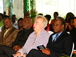
“GIS Day provides an international forum for users of geographical information systems technology to demonstrate real world applications that are making a difference in society,” Acting Chief Administrator Paul Thomas said. He added that the use of GIS applications could foster economic growth and development for Tobago.
Themed ‘Discovering the world through GIS’, GIS Day was hosted by the Division of Planning and Development with the aim of heightening awareness and use of the technology and its benefits. The event was held at the Gulf City Mall in Lowlands.
Chief Secretary Orville London speaking at the event said “technology is ever evolving” and that “We have to look for ways and means by which we can utilise it to enhance the way we do things in Tobago.” He further stated that “The use of technology is not just a development strategy, it is a survival imperative, because if we do not embrace and utilise the technology, those who do so, will overwhelm us in our own space.”
Last month, a team of THA representatives, headed by the Administrator of the Division of Planning and Development, Karen Ottley, attended the Urban and Regional Information System Association Caribbean Geographic Information System Conference in Curacao to learn more about GIS and its impact on businesses and organisations.
A government organisation that utilises GIS technology is the Tobago Emergency and Management Agency (TEMA) to map environmental hazards.
